This website is run by FRIERN BARNET & DISTRICT LOCAL HISTORY SOCIETY. To view our main website click on this link: www.friern-barnethistory.org.uk.
Other websites covering the London Borough of Barnet are:
BARNET LOCAL STUDIES & ARCHIVES
BARNET MUSEUM
THE FINCHLEY SOCIETY
HENDON & DISTRICT ARCHAEOLOGICAL SOCIETY
FRIERN BARNET & WHETSTONE RESIDENTS’ ASSOCIATION
FRIENDS OF FRIARY PARK
MILL HILL HISTORICAL SOCIETY
MAPS
 New Southgate (formerly Colney Hatch) in 1867 In 1867, only the central part of New Southgate was built up. It was still called Colney Hatch at th...
 Former New Southgate Gas Works The gas works site was a major employer. It closed in 1972. This map dates from 1951
 Former New Southgate Gas Works This plan of the Gas Works at New Southgate, and surrounding roads, has been overlaid with the re-ro...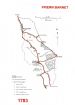
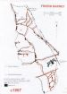
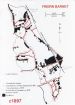
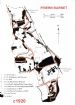
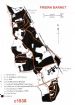
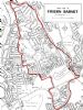 Friern Barnet UDC area The area outlined in red is that of the former Friern Barnet Urban District Council
 New Southgate (Colney Hatch Park) This map shows the location of Jerome K Jerome's family home in Springfield Road (1870-71), marked i...
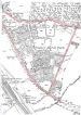 New Southgate "Colney Hatch Park" was later renamed New Southgate
 North Finchley Ordnance Survay map of 1881
Latest Pics


